


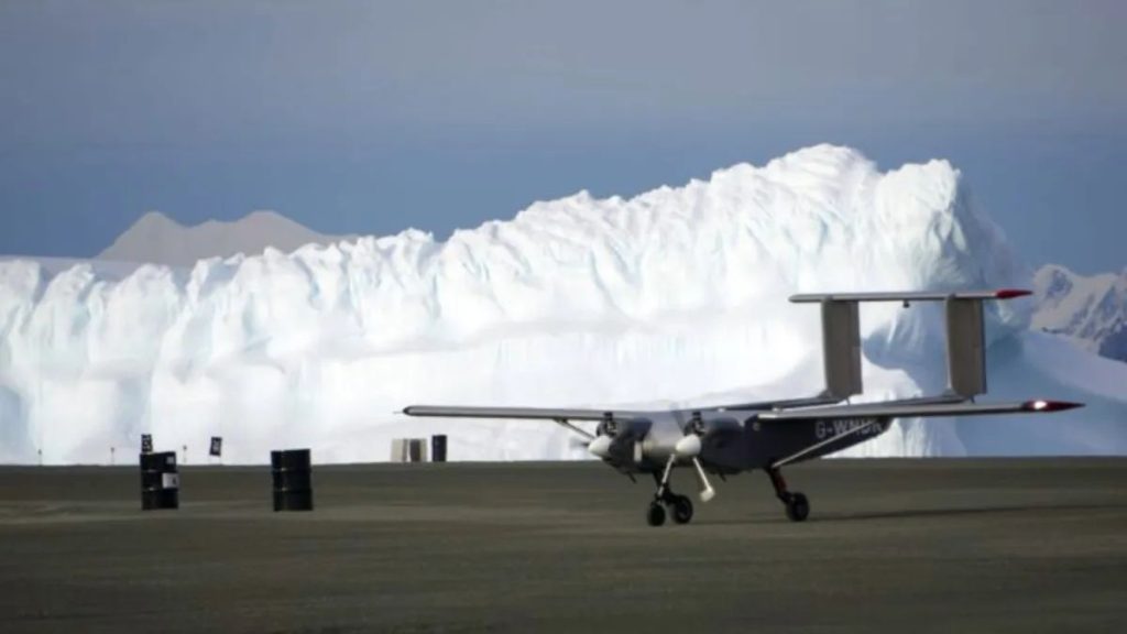
A cutting-edge autonomous aircraft has been introduced to extensively explore the white continent: Antarctica.
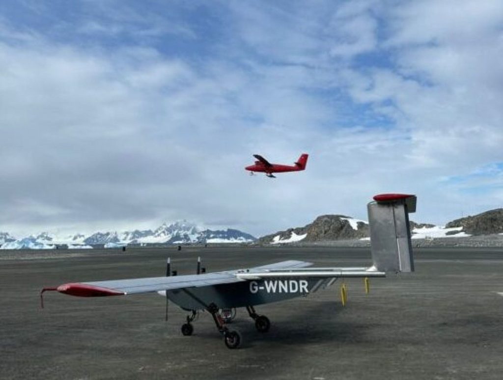
The Windracers ULTRA, an uncrewed aerial vehicle (UAV), is set to undergo testing over the skies of Rothera Research Station of the British Antarctic Survey (BAS).
This innovative robotic plane will enable researchers to map the length and breadth of this frozen region.
The drone will gather vital airborne data on polar climatic conditions, allowing experts to better understand the impact of climate change on the region.
“Demonstrating that UAVs can robustly and routinely collect an array of different data is really exciting for the future of Antarctic science,” said Tom Jordan, a geophysicist from BAS with expertise in airborne data collection.
“Polar science urgently needs extensive new high-resolution datasets to understand the ways the Antarctic ice sheet is changing, and how this will impact communities around the world. This is our first step toward unlocking those logistical barriers,” Jordan added.
This automated plane could fly for extended hours
This aircraft can carry out scientific observations more cost-effectively and with a reduced carbon footprint compared to conventional crewed aircraft.
As per the release, this airborne technology has the potential to cut carbon dioxide emissions per flight hour by almost 90 percent.
Furthermore, this entirely autonomous drone has been designed to extend flight durations and enhance overall geographic coverage, thereby improving scientific observations.
The drone features a twin-engine, 10-meter fixed-wing aircraft layout.
The drone is designed to operate in harsh climatic conditions and can continue to fly even if one of its engines or other vital components is damaged or fails.
Additionally, ULTRA is engineered to be easily repaired using a minimal number of parts.
Aircraft equipped with high-tech sensors, radars, and cameras
Through the series of tests, engineers and scientists will showcase the drone technology’s ability to collect a wide range of atmospheric and environmental data in Antarctica.
Airborne data is essential in the realm of polar climate science and ecology for understanding atmospheric conditions, glaciology, and ocean ecosystems.
In this current testing phase, the automated aircraft will collect data and examine “environmentally protected sensitive areas” in Antarctica.
Its tasks include studying the marine food chain with high-tech cameras onboard the craft.
Furthermore, it is assigned to explore tectonic structures with the help of magnetic and gravity sensors. In addition, it will use airborne radar to analyze glaciological formations and test an atmospheric turbulence probe.
If it passes all critical testing, the new drone platform might become a key tool for aerial scientific surveys in not just Antarctica, but also other distant parts of the planet.
The device’s capabilities might be improved by using numerous autonomous drones that operate as a single system using AI-driven SWARM technology.
“Having spent the last eight weeks completing rigorous tests and training, we’re enormously excited to have made it to Antarctica. We very much hope to demonstrate that high endurance, high payload autonomous drones have a valuable role to play in the future of environmental research,” said Tom Reed, Autopilot Technology Lead at Windracers Group and a member of the test team in Antarctica, in the press release.


+ There are no comments
Add yours